Backpacking Adventure in Rainbow Range Wildness-Tweedsmuir Provincial Park
Day 1, Rainbow Range Trailhead to Octopus Lake- Into the Wild
Sep. 09, 2023 Distance: 16.2 km, total elevation gains: 340m
We parked our vehicles at the Tweedsmuir Park Trailhead, just past the charming first nation town of Anahim Lake. As we strolled toward the trail, an outhouse and a friendly wildlife board welcomed us with a list of potential companions for our journey – bears, rock Ptarmigans, mountain goats, and woodland caribou. It was like having a wildlife show before our adventure, and we were thrilled to encounter these incredible creatures.

Throwing on backpacks heavy enough to make Hercules break a sweat, the Magnificent Six of the Pacific Northwest Outdoor Association (PNOA) set off on their epic quest. At the first fork on the trail, we chose Octopus Trail to the west as planned, with wonder about what it really looks like—a lake named after a multi-limbed sea creature. The initial leg led us through an old burnt forest that had seen better days. It looked like Mother Nature had decided to host a barbecue party, with trees crisped to a golden brown and light black. But soon, the landscape transformed into subalpine meadows dotted with lakes surrounded by neon-yellow sedges, and things got wilder.

As we ventured into a dense old-growth forest, where we encountered bear droppings and freshly dug bear beds, we knew we needed to avoid surprises, and we weren’t the only ones. So, we tuned up our vocal volume and gave a performance that would make rock bands jealous, all in the name of bear avoidance.

As we ventured into the subalpine territory, we noticed something unexpected – trail markers had become rarer than unicorn sightings, especially in marshy areas where trails played hide and seek. We employed our best tricks: GPS maps, trail marker scavenger hunts, and the good old “trial and error” method. At one point, we even fanned out like a trail-seeking SWAT team, each of us on the lookout for even the tiniest hint of a path.
But wait, there’s more! Fallen trees turned out to be our new arch-nemesis. Sure, some trails had been cleared years ago, but others were intact for ages, as if they were challenging us to a game of wilderness limbo. We dodged and weaved around those colossal logs, feeling like contestants on an extreme obstacle course on a TV show.
After about two hours, we entered a fresh burn zone. The contrast was astonishing – blackened forest against fresh meadows and crystal-clear lakes. It was like stepping into a monochrome movie, where nature decided to add a splash of color for dramatic effect. We even stumbled upon a trail closure notice, dated July 16, 2023, while the BC Parks website noticed the area closure in early August. Somewhere, some poor hikers had their wilderness BBQ interrupted, and we couldn’t help but wonder if they were still marinating in their misadventure.


As we approaching our campsite, things got a bit frustrating. BC Parks mentioned a campsite on the Northshore of Octopus Lake, but nowhere could we pin it on apps without GPS coordinates. So, we hiked on and on, feeling like trail detectives armed with a GPS-driven treasure map. At one point, my Maps Me showed we had passed the campsite on our left side, it turned out we made a big omega circle in dense forest without clear feeling of circling. We stuck to the trail with the hope that BC Parks would not play tricks with hikers, after all, it wasn’t Halloween yet. Suddenly, after six hours of hiking acrobatics, we spotted a BC Parks sign pointing us 1 km south off the main trail to the campsite.

With our last reserves of energy, we raced to the site with sour ankles and shaking knees, expecting nothing more than a flat spot to lay our weary heads. But what awaited us was sheer magic – a stunning campsite equipped with four perfect tent pads, a bear-proof food vault and a toilet, sitting on a breathtaking lakeshore waiting for us. It was like stumbling upon the 5-Star Hilton of the wilderness, and our trail detection was well rewarded. We high-fived in triumph, feeling like we’d discovered the Lost City of Campsite. And to top it off, we had the place all to ourselves, as if the great outdoors had rolled out the red carpet just for us.

Day 2 from Octopus Lake to Rainbow Cabin- Navigating Nature’s Maze: A Day of Challenges
Sep. 10, 2023 Distance: 15.8 km, total elevation gains 440 m
The second day dawn broke with a sweet scent. It was a beautiful day under the glorious morning sky. But as much as we’d fallen in love with our campsite by Octopus Lake, our quest beckoned us onward. We didn’t have time to wait for our tents to dry after a night of light showers, so, with a heavy heart and reflective lake shots, we packed up, leaving behind our lakeside paradise at 9 am.

Our journey took us westward, and soon enough, we passed by the Horse Camp. It boasted four lovely tent pads and even a toilet, but the real showstopper was the food storage – a towering structure, 4 meters above the ground, accessed by an aluminum ladder. We couldn’t resist the temptation to climb up and check it out. However, after examining what could’ve been if we’d stayed there instead of that 1 km detour from the main trail, reality hit us like a wet sock. The Horse Camp had its charm, no doubt, but it couldn’t compare to the stunning lake view and crystal-clear water right at our campsite. While the horses might have the stamina to trek for miles to find water, we humans cannot compete. So, we ventured onward with no regrets.

Soon, we reached the intersection of the Tweedsmuir trail and Octopus trail. We turned onto the Tweedsmuir trail heading north. As the trail ascended into the subalpine realm, the views began to unfurl. After about three hours of hiking, we stumbled upon an unnamed lake, its northern shore adorned with red rocks and framed by golden alpine grass, with patches of evergreen in the distance. It was a picture-perfect spot for lunch, so we had our energy bar /nut lunch break in the warm sunlight while enjoying our lakeside. It was a worthy location for a feast. We opted for a simple lunch break so we would not miss any highlight, Tim and Lisa’s photo poses would make professional models jealous.

With our spirits rejuvenated and bellies filled, we picked up the pace, ready to conquer the unknown. Little did we know that finding the trail would become a daily ritual. After traversing all around a vast, dried-up meadow, we finally spotted red ribbons and peak ribbons on the other side. Some of the intervals between markers were excessively long, so we did what any responsible person would do – we added a little “cut and tie” at spots where we wasted time to detect the traces of the trail or made cairns more visible by stacking more rocks.

As we ascended to higher elevation, the trail seemed to stretch on and on endlessly. The meadows grew lusher and more expansive, a symphony of colors dancing in the alpine breeze, with dark-hued coastal peaks in the distance. As forecasted, the light rain arrived in time when we climbed up the last stretch of trail before the mountain top.

Well prepared for all weather conditions, The Magnificent six put on rain gear and conquered the last strenuous section to the pinnacle of a ridge, where a breathtaking revelation unfolded right before us. Like a painter’s palette, a range of rainbow-colored peaks stretched out. Our destination, the Rainbow Cabin, couldn’t be far off. With hearts pounding, we descended toward a creek, some of us believing that following the creek was the way, based on Avanza Map used by 4 of 6 members, while 2 of us, however, thought we should stick to the actual trail as Avanza Maps has a paper-like interface on which outstanding trails may better serve as a reference rather than the actual trail for navigation. In the end, democracy ruled. We trekked uphill toward the Terraces, but we were no closer to finding a hint of a trail half an hour later. Our inner compasses and experience pulled us back, and we backtracked along the old-fashioned, non-digital trail we had left behind. As we clambered down from the steep cliff-side ridge, we couldn’t help but feel a big relief. Turns out, the real trail wasn’t that far from where we had stopped.

Back on the real trail, we tuned up the pace, darting through the forest despite the occasional obstacle of fallen trees. Closer and closer we drew to our holy grail – the Rainbow Cabin, with its signature red roof. It felt like coming home after a wild adventure. Our imaginations danced with visions of neat beds, a cozy dining table, and a warm wood stove.

Rainbow Cabin
While the cabin renovated in 2019 did have its rustic charms, it also harbored a rat metropolis. When we discovered more rat feces than we could count, and only two beds for our six weary bodies, we decided to set up our trusty tents outside while enjoying the cabin’s comfort for cooking our second dinner. Luck was on our side as the rain began to fall just as we started pitching our tents. We hustled and managed to complete setting up our little haven before the soothing rhythm of nature lulled our six tired adventurers into a deep dreamland.
Day 3 Mackenzie Heritage Trail- Tracing History’s Footsteps and Encounter with a Grizzly
Sep. 11, 2023 Distance: 16.3 km, total elevation gains 930 m
Our third day in the wild promised to be an arduous day of hiking, a journey steeped in history and drenched in rain. Our ambitious plan was to conquer 18 kilometers, a path that would lead us to the legendary Mt. Mackenzie and Mackenzie Pass. This trail was more than just a path; it was a route once frequented by the coastal Aboriginal people for their grease trade with the interior First Nations. It was a trail that echoed with the footsteps of the intrepid explorer Alexander Mackenzie in July 1793. Mackenzie’s journey was nothing short of epic – he had ventured from Montreal all the way to the Chilcotin Plateau, becoming the first person to conquer the North American continent from the Atlantic to the Pacific.

Undaunted by the relentless rain, we embarked on this historic journey, representing our group of six. As we ascended via the Alexander Mackenzie Heritage Trail towards the summit of Mt. Mackenzie, my trusty InReach Mini was put to good use. I kept my promise to our companions back in the cabin, providing updates on our safety amidst the howling winds and rain.
The climb itself was challenging, but it was about to become a day we would never forget. The highlight came in the form of an unexpected encounter with a grizzly bear – a majestic and humbling moment that would be etched in our memories forever.

Our adventure began with a bout of bushwhacking through alders. It didn’t take long for my pants to be soaked and my socks to become drenched. To add to the challenge, there was a lack of signage to guide us to the Alexander Mackenzie Trail. Instead, we unknowingly veered onto the Tweedsmuir Trail. Fortunately, my internal GPS kicked in, and I sensed something was amiss. We retraced our steps, rectified our course, and soon found ourselves back on the Alexander Mackenzie trail.

We persevered through approximately one kilometer of bushwhacking and crossed a creek to spot a trail marker in the forest. As the trail gradually ascended from the valley, our spirits lifted and the rain finally ceased, and trail markers began to reappear. During our hike, we encountered three fallen wooden trail posts, which we dutifully set upright before reaching the big bend on the Alexander Mackenzie Trail at the top of a notch.
The weather grew increasingly windy, and the drizzles returned. However, our determination remained unshaken. Leaving the trail behind, we ascended the ridge toward Mt. Mackenzie. Upon reaching a slope, our hearts skipped a beat as we found ourselves just ten meters away from a cinnamon-colored grizzly bear. We maintained our composure, gently spoke to the bear to announce our presence, and it gracefully acknowledged us before returning to its meal. Continuing along the ridge, we received yet another surprise – a big black bear down in a gulley beneath us. To encounter two different bears in such proximity was an unexpected twist in our adventure.

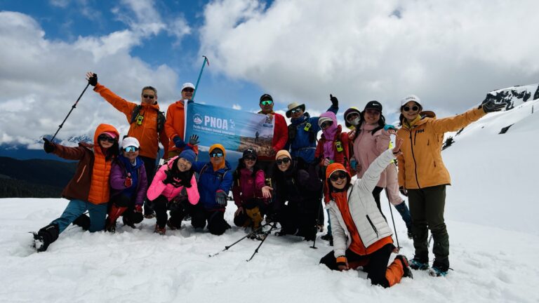
Upon reaching the summit of Mt. Mackenzie, we rejoiced in fulfilling our mission of taking photos with the PNOA banner. However, heavy fog thwarted our plan to traverse a few more kilometers along the peak to reach Mackenzie Pass. The unpredictable weather forced us to retreat and head back to the cabin.

But there was one final twist in our day. As we began our descent, we found ourselves on the wrong side of the mountain after approaching a few white rocks which we thought as Mountain Goats in thick fog. Frustrated but determined, we retraced our steps back up the steep cliffside to the peak. On our second descent attempt, the skies suddenly cleared, and we stumbled upon a patch of vivid Fireweeds in full bloom, providing a radiant spot in a day that had seen its fair share of weather turmoil.


Remarkably, we arrived back at the cabin earlier than our cabin mates had expected. While waiting for our return, Lisa took the initiative to clear a good section of the Heritage trail by chocking off overgrown alder bushes. At the same time, Suzey reattached a trail direction plate burred in bush to a signpost once the rain had stopped. These seemingly small yet impactful actions would prevent other hikers from making the same mistake that had added unexpected twists to our day hike journey.
Day 4 The Wilderness Odyssey Continues – Rainbow Cabin to de Macedo Lakes
Sep. 13, 2023 Distance: 17.7 km, total elevation gains: 880 m
Day four of our journey proved to be the ultimate test of our stamina, as we embarked on an 18-kilometer odyssey with a daunting elevation gain of nearly 900 meters. Fully aware that this leg of the trip would take us far from well-marked trails, we made the decision to start our day earlier than usual. The Heritage Trail, heading north, marked the beginning of our adventure. However, our enthusiasm was quickly met with a formidable obstacle in the form of thick alder bushes, standing nearly two meters tall, voraciously engulfing the trail.

Undeterred by this wilderness challenge, we dispersed like intrepid explorers on a treasure hunt, combing the forest’s edge in search of that elusive marker guiding us to Crystal Lake. It was a mission that would test our determination and resourcefulness.

After a trying 45-minute quest, we finally unearthed the marker, though it had chosen to play with us by resting on the ground. With a touch of creativity and Hugh’s ingenuity, we carefully attached it back onto its wooden post, ensuring that the sign pointing the way to Boyd Pass and Crystal Lake was prominently displayed. Our journey, however, had only just begun.

The next formidable challenge loomed ahead – a heart-pounding, thigh-burning ascent spanning 4 kilometers to Boyd Pass. Upon reaching the summit, a stunning alpine lake, none other than Crystal Lake itself, graced us with its presence. With our leg muscles worn from the demanding climb, we decided it was the perfect moment to pause for a well-deserved lunch break. Yet, the brisk mountain winds reminded us that we stood at a special place – Crystal Lake wasn’t your run-of-the-mill stop; it was a primitive backcountry campsite, complete with a bear-proof food cache and even a toilet.

With newfound energy and determination, we continued our expedition, heading southeast along what was loosely labeled as the Crystal Lake trail by BC Parks. However, our boots trod upon unmarked ground, with nothing more than cairns, in various shapes and sizes, to guide our way through the vast alpine tundra. As we ventured further off the trail, we embraced our roles as pathfinders, each forging our unique path but ensuring that we always aimed for the same distant landmarks. It was a true testament to our team’s spirit and shared resolve, transforming every member into a trailblazer. Despite the absence of marked routes, our collective determination served as our guiding star.

Our journey led us through three mountains and two valleys, each terrain more challenging than the last. However, our perseverance brought us to the final stretch of our wilderness odyssey, a gentle ascent through a valley bottom. Luck was on our side, as this terrain allowed us to regain control over our tired legs.


By 6 PM, we arrived at our lakeside campsite, nestled in a high, cold depressed area surrounded by three pristine alpine lakes. This remote site lacked the typical bear-proof food caches found in other provincial and national parks, and the towering trees necessary for hanging food were conspicuously absent. In the words of Tim, with his trademark humor, it was a place so remote that even the birds hesitated to relieve themselves. Nevertheless, guided by the principles of outdoor ethics and our unwavering commitment to leaving no trace, we conscientiously dug holes and carefully fulfilled them, ensuring that no evidence of our visit remained in this untamed wilderness.


At sunset, we were given a very special welcome by our seemly cozy campsite with a plunging temperature and bone chilling winds. Luckily enough, Lisa like a treasure box, took out her huge tarp and we immediate installed a wind barrier to provide bit comfort allowing us to have our first very wild dinner around a rock at freezingly cold alpine lake.

Day 5: Rainbow Range Day Hike – A Day of Scenic Wonders
Sep. 14, 2023 Distance: 11.5 km, total elevation gains: 700 m
Our fifth day on this incredible journey was nothing short of exhilarating. In just 8 kilometers of ridge-roaming, we experienced an adventure that would forever be etched in our memories. The remarkable Rainbow Range unveiled awe-inspiring vistas at every twist and turn, treating us to a visual feast like no other.

Ascending the Rainbow Range and its three peaks, we were greeted by an astonishing array of landscapes. The southernmost peak, Tusulko Peak, stood tall and proud, reminiscent of the iconic Black Tusk in Garibaldi Provincial Park. Its imposing presence commanded attention for kilometers around. But that was just the beginning of our sensory journey.

Atop the Tusulko Peak, It was the perfect fun time with demonstrations of our acrobatic skills and artistic talents inspired by unstable 360-degree panorama. Some were not satisfied with the elevations high enough by adding aerial maneuvers in their pictures, while, and others spell out “PNOA” using rocks.


360 At the northernmost point of North Ridge, we were gifted an unobstructed view of the most beautiful section of the entire Rainbow Range. The scenery seemed almost surreal, as if we had stepped into a painting crafted by Mother Nature herself.

As stumbling down the Black Mountain, we suddenly spotted a grizzly bear in the distance. Time seemed to stand still as we watched the majestic creature gracefully navigating its untamed domain. The fact that it was so close to our campsite, that it wouldn’t have been surprising if it had wandered through our tents in the night. This humbling and heart-pounding moment served as a reminder of the untamed beauty of these lands and our correct precautionary actions. In response to potential bear attraction by foods without trees, we diligently stored our food in dry bags and bear-proof canisters, ensuring they were kept in a lower depression area on down winds and well away from our tents sleeping area, a necessary precaution in this bear country.

But the surprises didn’t end there. Upon reaching the final peak (Northpin peak), we were greeted by an unexpected welcoming committee – a group of about ten mountain goats. These ethereal, white-coated creatures stood out vividly against a brilliant yellow meadow and the clear blue sky. What struck us even more was their curiosity and friendliness as they followed us along the difficult terrain, as if to say, “Welcome to our world.” These delightful companions made our day in the Rainbow Range truly unforgettable.


With every step, we couldn’t help but feel like we were dancing with the colors of the rainbow, surrounded by the majesty nature. Our laughter echoed through the mountains, and our hearts swelled with joy as we shared this remarkable encounter with the wild. It was a day when the mountains whispered secrets, the bears shared their majesty, and the goats joined us in celebration. In the Rainbow Range, we found not just adventure, but pure, unbridled magic.

Day 6: From De Macedo Lake to Rainbow Trailhead-A Thrilled Triumph
Sep. 15, 2023 Distance: 17.8 km, total elevation gains 570 m
Our sixth and final day on this epic adventure was destined to be one for the books. As we prepared to depart from our cozy campsite at De Macedo Lakes, we couldn’t help but reflect on the incredible journey we had undertaken. But before we embarked on our last leg of journey, Yuki, Hugh and I decided to complete unfinished business from the previous day – the challenging South Ridge. Once we conquered South Ridge in 2 hours, we left our last camp site and strike on the last journey along the largest of the three De Macedo Lakes.

Stumbling upon a faint horse trail just beyond the largest of the De Macedo Lakes filled us with excitement. It was a promising discovery in the valley, and we eagerly followed its trace until it suddenly disappeared into the golden grass. Undeterred by its vanishing act, we pressed on, relying on the GPS route we had charted for ourselves. Our path led us to ascend a notch on the hilltop and then proceed southward, all the while keeping a sharp lookout for any signs of familiar Cairns, those charming stone piles also known as Inuksuk.
Suddenly, to our left, as we wandered through a small plateau adorned with a few serene lakes, a small but unmistakable Cairn appeared in our field of view. “Yeah, we’re back on the trail!” we cheered, making a few twists and turns among the large boulders on this moon-like plateau. The trail became clearer and clearer as it descended into the alpine meadows below.


Passing by the scenic McCulley Lake, the rest of the journey felt like a pleasant breeze blowing through brilliant autumn foliage. At that point, it seemed like the only item left unchecked on our wildlife buffet was the woodland caribou, especially as we came across two hikers—the only other humans we had seen since we embarked on this wild adventure five days ago!


By 3:30 PM, we arrived back at the Rainbow Trailhead, a strange mix of exhaustion and exhilaration washing over us. We had done it! Our wild trek had come to an end, and we couldn’t help but share hearty laughter and exchange high-fives. Although our wildlife menu was not quite complete, from the crystalline blue alpine lakes to the brilliant yellow meadows and the charming wooden board bridges spanning small creeks, our hike back to civilization felt like a visual feast.


Over 6 days in wildness adventure, we left no trace behind, but brought tonnes of photos and best memories. Popular hiking apps like Google Offline Maps, All Trails, Maps Me as well as Gaia, all turned mute for the routes we have passed through in Rainbow Range area of Tweedsmuir park, which probably deterred some of hikers away from exploring the pristine beauty nowhere can find in Canada. The GPS tracking charted by our self may serve as a valuable resource, providing convenience and confidence to future trekkers.

Our footprint of 6 days
Claimer: The GPX files of the routes we’ve taken are provided for reference only. If you are interested in following our routes, please assess your own abilities, equipment, and navigation skills. Due to any accidents or injuries that may occur while hiking our routes, PNOA and the author of this article are not responsible